| Version 2 (modified by , 8 years ago) (diff) |
|---|
Maps Wiki
Documenting the lessons learned in trying to make a topographic world map using Maperitive and other tools. Most of this wiki will describe the process used to create a world topographic map (ie: shading based on mountains and other terrain). Adding urban data such as streets, place names, and borders was attempted but not finished.
All of the files referenced here have been downloaded to or backed up on a WD Elements 6TB USB drive currently plugged into the Michigan computer at the SDI office.
Maperitive
Maperitive is a free application for generating maps from Open Street Map data. It is also able to generate terrain maps using a set of NASA-created global height data called SRTM. The end goal of the operation is to output the map as Web Tiles, a set of static images at varying "zoom levels" which can be tiled together to make a seamless map.
The downside to this is that the entire earth is very big and requires a lot of RAM to hold all the data when the map is zoomed in far enough. The solution to this was to use scripts to break the planet up into smaller pieces which can be individually processed.
SRTM Data
Maperitive uses NASA SRTM data to generate shaded terrain maps. In the past, Maperitive was able to connect to NASA's servers and download the data as needed. Since then, NASA has locked down the servers behind a free password. A newer version of Maperitive exists which might have a workaround for this issue, but this documentation presumes Maperitive can't download the data. Instead of Maperitive downloading the data, it can be downloaded manually and then just placed in a location that Maperitive expects SRTM data to be; then it will not attempt to download it again.
The SRTM data comes in two resolutions:
- SRTMGL1, 1-arcsecond data, divides the earth into images covering 1x1 degree lat/long of most of the land. Each file is 3601x3601 16-bit pixels (~26MB).
- SRTMGL3, 3-arcsecond data. Each file is 1201x1201 pixels (~2.8MB).
If downloading more than one file at a time, SRTM data is most easily obtained from NASA's servers using the Daac2Disk utility. This example command will download the entire SRTMGL1 dataset to the SRTMGL1 folder: Daac2Disk_win.exe --shortname SRTMGL1 --versionid 003 --nometadata --outputdir SRTMGL1.
To download the data from the web or using Daac2Disk, you will need NASA Earthdata account: https://urs.earthdata.nasa.gov/home. Once you have created your account, log in and from "My Applications", add the LPDAAC Data Pool.
Attachments (1)
-
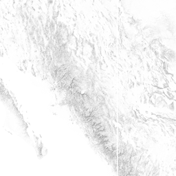
13.png (54.8 KB) - added by 8 years ago.
Sample_Terrain
Download all attachments as: .zip